Log in
All resources
Create a design
49 Free Images of Maps By Jan Janssonius
maps in the rijksmuseum amsterdam
maps by jan luyken
prints by frans hogenberg in the rijksmuseum amsterdam
frans hogenberg
national library of poland
prints by jan luyken in the rijksmuseum amsterdam
atlas ou representation du monde universel t. 2 (1633)
copper engraving print
maps by jodocus hondius
maps by pieter van der keere
atlas van der hagen (volume 1)
atlas van der hagen
maps of amersfoort by braun & hogenberg
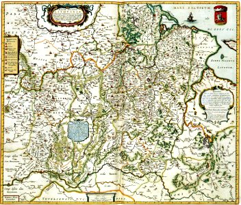
maps by jan janssonius
maps by jodocus hondius
old maps of virginia
17th-century maps of the black sea
maps by willem and johannes blaeu
maps by gerard valck
copper engravings
atlas ou representation du monde universel t. 2 (1633)
maps by jan janssonius
maps made in the 17th century
old maps of gelderland
maps by hendrik hondius the younger
cartouches by jan janssonius
eran laor cartographic collection
old maps of canaan
17th-century maps of the mediterranean sea
copper engravings
national museum of maps and rare books, bucharest
maps of the lower danube
maps in the library of congress
animals on maps
map of ghent by jan blaeu
maps by jan janssonius
1650s maps of romania
maps by willem and johannes blaeu
old maps of the danube
maps by jan janssonius
1640s maps of africa
stedenboeken van de wereld by johannes janssonius 1657
map of ghent by jan blaeu
17th-century maps of southeast asia
maps by jodocus hondius
17th-century maps of istanbul
maps by jan janssonius
maps by jan janssonius
jodocus hondius
atlas ou representation du monde universel t. 2 (1633)
old maps of the republic of genoa
dutch 17th-century prints in the rijksmuseum amsterdam
old maps of the hague
atlas ou representation du monde universel t. 2 (1633)
old maps of nuremberg
prints by frans hogenberg in the rijksmuseum amsterdam
maps in the rijksmuseum amsterdam
maps of barbary coast by mercator-hondius
maps by jan janssonius
maps by pieter van der keere
old maps of basel
prints by frans hogenberg in the rijksmuseum amsterdam
maps in the rijksmuseum amsterdam
prints by frans hogenberg in the rijksmuseum amsterdam
maps in the rijksmuseum amsterdam
prints by frans hogenberg in the rijksmuseum amsterdam
maps in the rijksmuseum amsterdam
atlas ou representation du monde universel t. 2 (1633)
maps by jan janssonius
atlas ou representation du monde universel t. 2 (1633)
maps by jan janssonius
atlas ou representation du monde universel t. 2 (1633)
maps of the duchy of mantua
maps by jan janssonius
atlas novus (blaeu)
prints by frans hogenberg in the rijksmuseum amsterdam
maps in the rijksmuseum amsterdam
prints by frans hogenberg in the rijksmuseum amsterdam
prints by jan luyken in the rijksmuseum amsterdam
17th-century maps of cambridgeshire
old county maps of cambridgeshire
prints by frans hogenberg in the rijksmuseum amsterdam
prints by jan luyken in the rijksmuseum amsterdam
prints by frans hogenberg in the rijksmuseum amsterdam
maps in the rijksmuseum amsterdam
prints by frans hogenberg in the rijksmuseum amsterdam
maps in the rijksmuseum amsterdam
atlas ou representation du monde universel t. 1 (1633)
17th-century maps of scandinavia
maps of 's-hertogenbosch by braun & hogenberg
atlas beudeker
maps of bergen op zoom by braun & hogenberg
atlas beudeker
maps in the rijksmuseum amsterdam
old maps of vlissingen
prints by frans hogenberg in the rijksmuseum amsterdam
maps by jan luyken
maps in the rijksmuseum amsterdam
old maps of south holland
maps of emden by braun & hogenberg
atlas beudeker
prints by jan luyken in the rijksmuseum amsterdam
maps in the rijksmuseum amsterdam
dutch 17th-century prints in the rijksmuseum amsterdam
capture of wesel 1629
dutch 17th-century prints in the rijksmuseum amsterdam
capture of wesel 1629
1 - 49 of 49
/ 1